The Longwood University @ the Arctic Circle team is preparing for the 2018 experience in Alaska.
To apply for this adventure go to: http://go.longwood.edu/arcticcircle.

08 Thursday Feb 2018
Posted in Uncategorized
≈ Comments Off on LU@TAC 2018 is getting ready!
The Longwood University @ the Arctic Circle team is preparing for the 2018 experience in Alaska.
To apply for this adventure go to: http://go.longwood.edu/arcticcircle.
17 Thursday Aug 2017
Posted in Uncategorized
≈ Comments Off on Tuesday, June 27. Denali National Park
Today was the last official day of the class. We decided that it would be great to end the class with a excursion to Denali National Park. This was a surprise to the class and we told them at the end of the persuasive arguments assignment at Marion Creek Campground. Everyone was excited about taking this excursion! We had a very early start for the two hour drive south of Fairbanks to the national park.
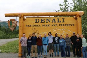
Danali National Park was a sharp contrast to the voyage taken in northern Alaska. There were more people at Denali National Park, while we were there, than the entirety of people that we saw along the five days traveling along the Dalton Highway and back — including Prudhoe Bay. There was so much commercialization around the park — shopping and hotels were abundant. We drove into the park and ate lunch in the park. We were able to get some great views and pictures of Mt. McKinley!

Mt. McKinley — It is the snow-covered mountain on the left side of the picture.
After lunch we had time for the last reflection — the turning point reflection. This was an opportunity for the students to reflect on how the journey to Alaska had affected them and influenced their views on travel, public lands, and general education.
On the trip back to UAF, we had a group dinner together to celebrate our time together in Alaska.
Once back at UAF, we ended the travel experience with a final meeting to debrief our day and to look forward to the future assignments that will be completed after the students return home. The class still will have about three weeks of coursework remaining. The students will take all of the information gathered in the travel portion in Alaska to help complete assignments.
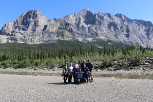
The students (and professors) had a wonderful time in Alaska. We all learned so much about the state of Alaska, the oil, and oil pipeline industry. It has given us all a new perspective to the oil industry.
17 Thursday Aug 2017
Posted in Uncategorized
≈ Comments Off on Monday, June 26, Marion Creek Campground to Fairbanks
After breakfast we broke camp and left for Fairbanks. The first stop was a quick stop at Coldfoot for gas — and some more coffee.
We stopped at Yukon River briefly for gas before continuing the journey to Fairbanks.
We stopped for lunch at Hess Creek. The bugs were very bad at this stop. Most people in the group wore bug nets most of the time outdoors because of the bugs — mostly mosquitoes.

Our final stop before Fairbanks was another stop at the Pipeline Vistors’ Center to recap the experience of the Dalton Highway.
We made it back to UAF (University of Alaska Fairbanks), where we stay in Fairbanks, in middle afternoon. The students had some time to move in, unpack, shower, and rest.
We ended the day with a trip to North Pole, Alaska. The goal was to eat dinner and have time for place-as-text North Pole, but the meal took a very long time, so there was not much time left for other activities there. We debriefed the trip on the way back to UAF. It was very different from what everyone expected.
31 Monday Jul 2017
Posted in Uncategorized
≈ Comments Off on Sunday, June 25. Deadhorse to Marion Creek Campground
This morning, we leave Deadhorse to return to Fairbanks. We will make it to Marion Creek Campground. Unlike the two campgrounds on the way to Deadhorse, Marion Creek Campground is the most modern: it has a water pump and a campground host. Having a water pump available is nice so that we are able to refill our water vessels. One major concern for us on our trip from Fairbanks to Prudhoe Bay and back was the lack of food and water (and gas) supplies available along the Dalton Highway. We purchased five to seven days of food that we carried with us for the entire time that we traveled. Except for our time in Deadhorse we ate the food from the coolers. Lots of bagels and sandwiches were eaten.
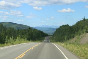
The Dalton Highway and the Trans-Alaska pipeline are fairly close together for the whole trip. Sometimes the pipeline is buried and sometimes the pipeline is above the ground. There are many times when the pipeline is not visible from the road. This was a little surprising to me as I expected the pipeline to be in view most of the time.
Pipeline farther away
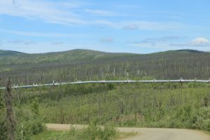
Pipeline closer to road
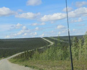
Road and pipeline close
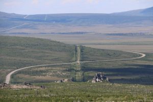
Pipeline buried
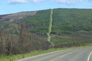
Pipeline
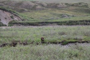
Driving back toward Fairbanks today, we see several herds of caribou and musk ox.
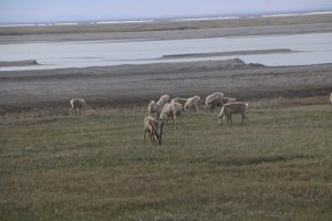
Caribou
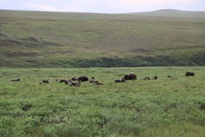
Musk Ox
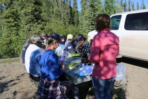
We stopped for lunch at Galbraith Lake campground — a very nice second visit. During lunch we had a very good debrief of our trip to Deadhorse and especially the Prudhoe Bay oil fields and the Arctic Ocean. These debriefs are one of the great benefits to these interdisciplinary courses. Each student observes something slightly (or not so slightly) different from another student. During these debriefing periods all students have a chance to share their observations and thoughts. The visit to the Prudhoe Bay oil fields helped students (and professors) to catch a small glimpse of the large footprint that the oil industry has on our society.
Approximately one third of jobs in Alaska are associated with the oil industry. The Alaska Permanent Fund dispenses payments each year to residents of Alaska. This fund was set up when the Trans-Alaska Pipeline was built so that all Alaskans would benefit from the oil transferred through the pipeline. The people of Alaska tend to have a positive view of the pipeline.
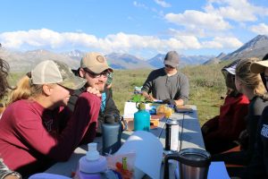
Debrief during lunch
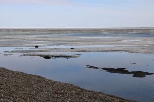
We stopped at one beautiful lake later in the afternoon. Unfortunately, no one remembers the name of the lake.
Beautiful Lake
Before dinner, we had time to take a hike into the forest surrounding the campground. At the end of the hike we spent some time on a personal reflection for the backcountry-as-text assignment. This was a wonderful place because there were no human-made sounds around — one hope for this assignment. It is very difficult to visit places that are completely quiet of engines and other human-made sounds. We were very lucky in Alaska to have many such places.
Marion Creek
Marion Creek
Dinner tonight was spaghetti. As discussed above, we had to buy meals that would be reasonable five to seven days later.
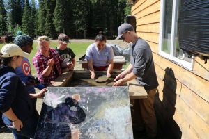
After dinner, the students participated in their Persuasive Arguments assignment. Each student was given a ‘stance’ on the pipeline issue (possibly one that they may not agree with) and was given 4-5 minutes to persuade the other students to agree with their stance. The students did very well with this assignment — very impressive work — especially since there was only a few days to prepare their argument.
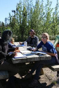
Students preparing for the Persuasive Arguments assignment
Beginning of the assignment delivery
We ended the evening with a nice conversation around the picnic table.
27 Thursday Jul 2017
Posted in Uncategorized
≈ Comments Off on Saturday, June 24. Arctic Ocean Excursion
Today, we went into the Arctic Ocean! The Arctic Ocean is not accessible to the general public because the Prudhoe Bay oil fields are along the entire coast. To access the Arctic Ocean, we must register for a tour (set up before we arrived in Deadhorse) — which requires giving basic information for a security check.
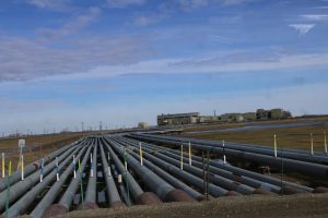
Multiple pipelines from different oil wells
We had a great tour of the oil fields. Our tour guide, AJ, gave us a lot of information about the operations of the oil fields. Although most of the oil wells are owned by two companies, BP and Conoco-Phillips, there are many international companies present for support and/or exploration. AJ had a lot of information about the Prudhoe Bay oil fields, and about Alaska more generally.
Then we arrived at the Arctic Ocean! All of us went in the water — it was COLD!
The Arctic Ocean
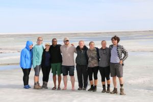
Students at the Arctic Ocean.
After our trip to the Arctic Ocean, we had some time for showering (and warming up) before lunch. After lunch, we took a trip to the general store. It was a fun trip. The store had a mixture of souvenirs and basic necessities.
The afternoon was spent working on assignments, talking with people around the hotel as a part of their place-as-text assignment, and resting. We had some free time during the evening so that the students would be ready to drive south on the Dalton Highway on Sunday.
While the students were resting, we had to replace a tire on the large van. We heard many stories that flat tires are not uncommon on the Dalton Highway. We were lucky that we did not have a flat tire while driving to Prudhoe Bay, but one tire did develop a leak and could not be repaired; so we had to replace it.
27 Thursday Jul 2017
Posted in Dalton Highway
≈ Comments Off on Friday, June 23. 140 miles from Galbraith Lake to Deadhorse.
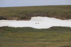
After packing camp, we took a walk toward Galbraith Lake. We spent time on the snow and had a great time. Galbraith Lake campground is another wonderful place to spend time. We spent time with one gentleman that works nearby at pump station number 4 and spends much of his time in the Galbraith Lake area. He was very enthusiastic and passionate about spending time here (at Galbraith Lake).
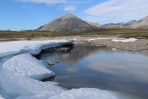
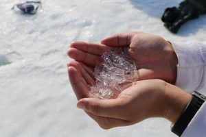
Ice crystals
Hike at Galbraith Lake Campground
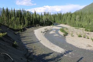
Today’s trip had fewer stops. The region north of Galbraith Lake is arctic tundra and has very few stops. There was several places where the road was under construction, and we were required to wait on the pilot car. This could take up to 20 minutes of waiting. During this time, there may only be two vehicles (our two vehicles) in line. Once there were four vehicles after about 15 minutes of waiting. That gives some sense of the isolation of our trip. Although we only traveled about 140 miles, it took much of the day.
We saw our first Musk Ox, and then a herd of musk ox!
Musk Ox
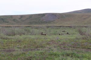
Musk Ox herd
We stopped for lunch out of the coolers at Happy Valley. There is a busy ‘air strip’ during the summer, but no planes landed while we were eating lunch.
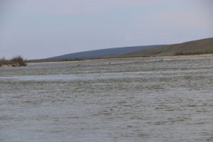
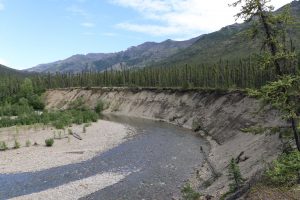
Sagavanirktok River (“Sag River”) at Happy Valley
After lunch, we saw the first caribou! And later we saw more caribou closer.
Caribou
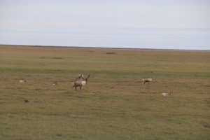
Caribou
And just before Deadhorse, we saw a grizzly bear (thanks Casey!). It was raining on this stretch of road, but the bear was fairly close — for wildlife. That really is a bear — and it looked much better through binoculars.
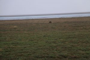
Grizzly Bear
We arrived in Deadhorse about 4:00 pm. We checked in to the Prudhoe Bay hotel and had time for a shower before dinner. We had been about three days without showers, and had been eating out of the coolers (bagels, sandwiches, and cookouts for dinner) since we left Fairbanks. We were all ready for a good meal.
The hotels in Deadhorse are simple. Most operate similar to the dorms — two single beds in a room, with a large bathroom down the hall. Our hotel had four “halls”: three were designated for males, and one was for females. One great feature is that the hotel has ‘free’ food available for guests 24 hours each day. The meals are served at designated times, but at any other time, one can go in and get sandwiches, desserts, and other items. The students enjoyed this particular perk of the stay.

Deadhorse is an industrial town in the Alaska tundra of Alaska. It was built to support the workers at the Prudhoe Bay oil fields. All of the structures are prefabricated, built from materials trucked up the Dalton Highway or brought by barge. Deadhorse has a very industrial feel. There is only one general store in the whole town. There are many international companies that help support the oil operations.
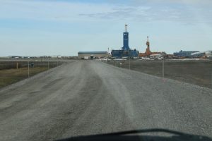
Prudhoe Bay, near the Prudhoe Bay Hotel
There are about 2,000 people living in Deadhorse, but only a few dozen permanent residents. The other people are oil workers. A common work schedule is to work about 2 weeks ( or 4 weeks) in Prudhoe Bay and then go back home for 2 weeks. During the time in Prudhoe Bay, they work 7 days each week, generally 12 hour days.
27 Thursday Jul 2017
Posted in Dalton Highway
≈ Comments Off on Thursday, June 22. 159 miles from the Arctic Circle to Galbraith Lake Campground
After spending the summer solstice at the Arctic Circle, we packed camp and headed north on the Dalton Highway for another busy day.
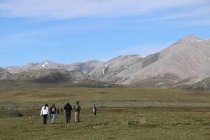
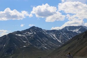
The first stop was at Gobbler’s Knob. We took a hike up to the top of Gobbler’s Knob. The views were spectacular.
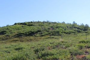
Students hiking up Gobbler’s Knob
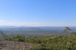
View from the top of Gobbler’s Knob
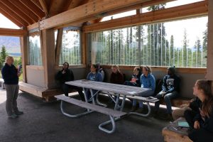
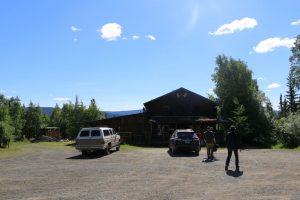
The second stop was at Coldfoot. Coldfoot is a very small place. We visited the Arctic Interagency Visitor Center. This is a wonderful, friendly, and educational place. The rangers were very nice to our group and were happy to answer the many questions we had. We were able to refill our water vessels and eat lunch there.
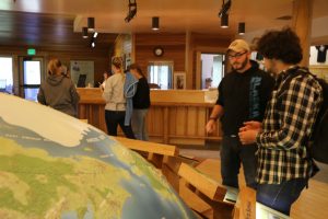
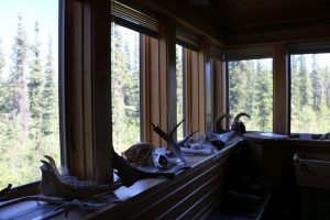
Inside the Arctic Interagency Visitors Center
Leaving Coldfoot, we begin a trek of 240 miles with services such as gas and food — the longest stretch in the United States!
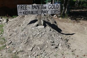
Continuing north, we stopped at Wiseman. This is another very small community with only 20 residents (and only 3 residents during the winter) on the bank of the Koyukuk River. We spent time talking with Clutch about the area. Clutch was so nice, and he gave us a lot of information — about bears, hunting, and gold mining. Clutch also gave us a lesson in how to pan for gold and some of us spent time practicing (alas, no major find was made).
Wiseman, Alaska
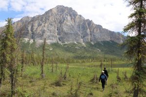
The next stop was at the Middle Fork Koyukuk River turnout. This was a beautiful stop next to the river with great views of Sukakpak Mountain.
Students at Koyukuk River, with Sukakpak Mountain in the background
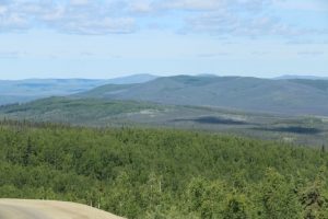
As we continued the travels north, the views are amazing. We saw a panorama of Dietrich River valley and the Brooks Range north and west. During this travel segment, we pass the last spruce trees of the trip north and enter the arctic tundra (“treeless uplands”).
Continuing north, we stopped at Atigun Pass Summit. This is the Continental Divide. Rivers to the north empty into the Arctic Ocean, while rivers to the south empty into the Bering Sea. This is the crossing of the Brooks Range. This is the highest highway pass in Alaska.
View from Atigun Pass Summit
Today’s drive was incredible. The vast expanse of Alaska was on display for most of the day. It is very hard to describe the beauty of the place. There are no man-made structures in view, except for the road and the pipeline (at times) and occasionally a pump station (there are six pump stations along the Dalton Highway. As we drove north today, we passed by the Arctic National Wildlife Refuge (ANWR) to the East and the Gates of the Arctic National Park and Preserve to the West.
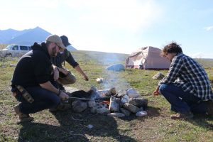
Finally we made it to the campground at Galbraith Lake. The campground is about four miles off the Dalton Highway, although it is still visible in the distance. The campsite was rustic, similar to the one at the Arctic Circle; but it did have a pit toilet. We had a nice hot dog cookout for the evening meal, along with S’Mores for dessert.
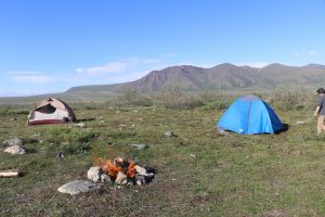
Camp site with fire.
We ended the day with a meeting to debrief about the day’s adventures and visitations, and a personal reflection in the solitude the Alaska. What a great day in Alaska!
07 Friday Jul 2017
Posted in Uncategorized
≈ Comments Off on June 21st – 199 miles from Fairbanks to the Arctic Circle
On June 21st we set out from Fairbanks with the intention of sleeping on the Arctic Circle. The Arctic Circle is he southernmost point at which the midnight sun is visible on the summer solstice. In other words, we got to experience Alaska’s famous midnight sun!
Driving to the Arctic Circle campground took us by some beautiful places:
First stop: Walmart in Fairbanks – not so beautiful, but necessary. There are very few stores between Fairbanks and Deadhorse.
Second stop: Trans Alaska Oil Pipeline Visitors Center in Fox, AK. Our class studied pipelines in Alaska and Virginia – so this was a must. Here we got to see our first pipeline pig.
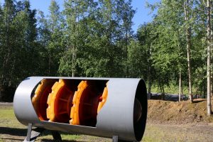
Pipeline Pig — used to inspect and clean pipeline
Third stop: Gas station in Fox, Alaska. This was the last time we saw gas for under $5.00 a gallon until we got back to Fox, six days later.
Forth stop: Lunch at the Arctic Circle Trading Post in Joy, AK. Gifts are available here. We ate “out of the coolers” on the front porch and were joined with a friendly squirrel (our first wildlife of the trip, luckily not our last).
Arctic Circle Trading Post
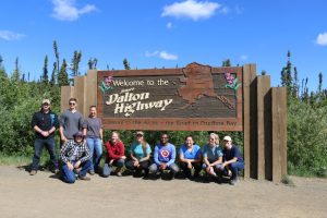
Fifth stop: Dalton Highway sign! To get to the Dalton Highway from Fairbanks you must travel about 70 miles of the Elliott Highway. We were excited to start up the famous Dalton Highway, made famous by the TV show, Ice Road Truckers. You can read a New York Times article about the Dalton here.
Sixth stop: Yukon Crossing Visitors Contact Station. This is a BLM (Bureau of Land Management) managed stop with access to gas and pit toilets. The students spent some time reflecting on the banks of the Yukon River.
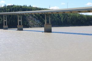
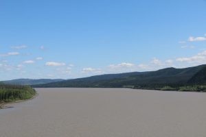
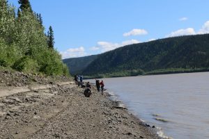
Yukon River
Seventh stop: Finger Mountain BLM Wayside. Here students climbed on rock formations that hunters used as markers for where they were and where they were going.
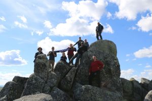
Students at the top of Finger Mountain.
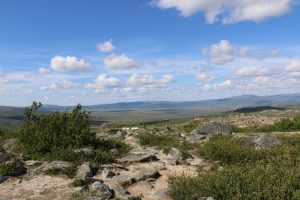
View from Finger Mountain
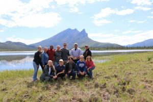
Around 6:00 pm we made it to the Arctic Circle. The position of the Arctic Circle is not fixed; as of 1 July 2017, it runs 66°33′46.7″ north of the Equator. I (Dr. Pederson) got our 12 passenger 4×4 van stuck in a mud puddle (a rather large mud puddle) on the way to our campsite. Camping at the Arctic Circle is rustic. There is one pit toilet for the entire campground. That is the only amenity.
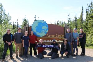
We made it to the Arctic Circle
Day one of the Dalton Highway was action packed. All along we followed the Trans Alaskan Pipeline. We would continue to do so for days to come.
Day two coming soon!
06 Thursday Jul 2017
Posted in Uncategorized
While on the Dalton Highway, we did not have internet or phone service. Therefore, the blog is behind schedule. As a way to catch-up and document our monumental journey, I will be adding a blog post for everyday we traveled over the next several weeks.
Stay tuned!
20 Tuesday Jun 2017
Posted in Uncategorized

Today was a busy day. Students started out at the Museum of the North learning about the culture, history, art, and ecosystem of Alaska. Then, we ate lunch at Pioneer Park. Pioneer Park is a public area that many tourist visit. From Pioneer Park, students went to the Morris Thompson Cultural and Visitors Center. There a park ranger explained politics of public lands in Alaska from many perspectives. Lastly, students discovered Fairbanks in their Place-As-Text exploration.
Tomorrow, we will leave Fairbanks to travel the Dalton Highway. I (Dr. Pederson) will not be blogging for a few days because we will not have internet or phone service. Mr. Josh Blakely will be updating the blog with our progress and locations.
Stay tuned!