
After spending the summer solstice at the Arctic Circle, we packed camp and headed north on the Dalton Highway for another busy day.
The first stop was at Gobbler’s Knob. We took a hike up to the top of Gobbler’s Knob. The views were spectacular.
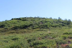
Students hiking up Gobbler’s Knob
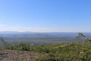
View from the top of Gobbler’s Knob
The second stop was at Coldfoot. Coldfoot is a very small place. We visited the Arctic Interagency Visitor Center. This is a wonderful, friendly, and educational place. The rangers were very nice to our group and were happy to answer the many questions we had. We were able to refill our water vessels and eat lunch there.
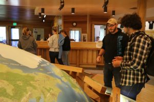
Inside the Arctic Interagency Visitors Center
Leaving Coldfoot, we begin a trek of 240 miles with services such as gas and food — the longest stretch in the United States!
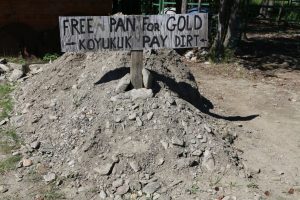
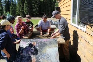
Continuing north, we stopped at Wiseman. This is another very small community with only 20 residents (and only 3 residents during the winter) on the bank of the Koyukuk River. We spent time talking with Clutch about the area. Clutch was so nice, and he gave us a lot of information — about bears, hunting, and gold mining. Clutch also gave us a lesson in how to pan for gold and some of us spent time practicing (alas, no major find was made).
Wiseman, Alaska
The next stop was at the Middle Fork Koyukuk River turnout. This was a beautiful stop next to the river with great views of Sukakpak Mountain.
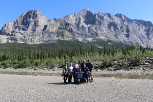
Students at Koyukuk River, with Sukakpak Mountain in the background
As we continued the travels north, the views are amazing. We saw a panorama of Dietrich River valley and the Brooks Range north and west. During this travel segment, we pass the last spruce trees of the trip north and enter the arctic tundra (“treeless uplands”).
Continuing north, we stopped at Atigun Pass Summit. This is the Continental Divide. Rivers to the north empty into the Arctic Ocean, while rivers to the south empty into the Bering Sea. This is the crossing of the Brooks Range. This is the highest highway pass in Alaska.
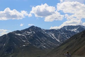
View from Atigun Pass Summit
Today’s drive was incredible. The vast expanse of Alaska was on display for most of the day. It is very hard to describe the beauty of the place. There are no man-made structures in view, except for the road and the pipeline (at times) and occasionally a pump station (there are six pump stations along the Dalton Highway. As we drove north today, we passed by the Arctic National Wildlife Refuge (ANWR) to the East and the Gates of the Arctic National Park and Preserve to the West.
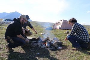
Finally we made it to the campground at Galbraith Lake. The campground is about four miles off the Dalton Highway, although it is still visible in the distance. The campsite was rustic, similar to the one at the Arctic Circle; but it did have a pit toilet. We had a nice hot dog cookout for the evening meal, along with S’Mores for dessert.
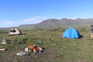
Camp site with fire.
We ended the day with a meeting to debrief about the day’s adventures and visitations, and a personal reflection in the solitude the Alaska. What a great day in Alaska!