Introduction to Geographic Information Systems
This course introduced ArcGIS mapping software and many of its functions such as creating layers, utilizing symbology to display layers in a useful fashion, digitizing polygons, and much more. Topics addressed included cartography, coordinate systems and map projections, data classification and generalization, methods of thematic map symbolization, GIS application domains, data models and sources, analysis methods and output techniques.
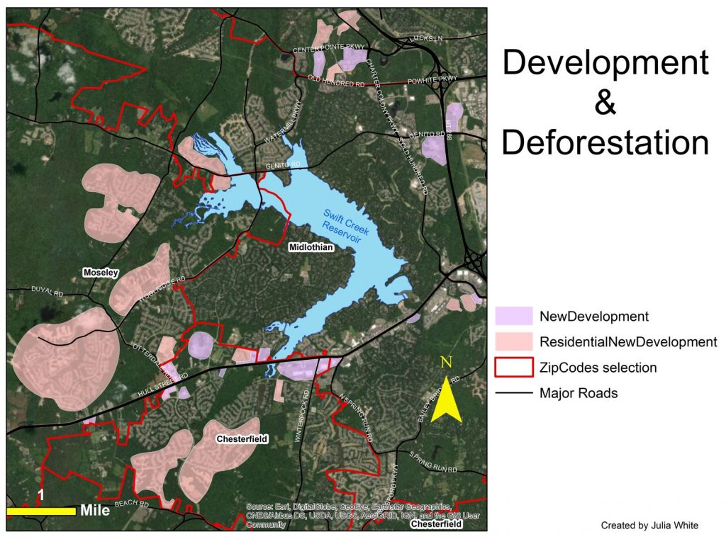
For a course project I looked at development and deforestation in my hometown. Deforestation doesn’t just happen in remote places like the Amazon rainforest. In the news media we often hear about faraway ecosystems being destroyed for lumber or development, but it also happens right in our own backyards. The majority of my life I’ve lived in the Midlothian/Chesterfield area of Virginia. Over the years my family has seen thick woods and natural land be converted to Walmarts, car dealerships, and fast-food places, as well as lots and lots of neighborhoods. Years ago we used to see groups of wild turkeys roaming around the area; now, with all the construction one is a rare sighting. In order to depict the extent of the recent development in my own area, I created a map digitizing areas of new development. With this information visualized (see image below), the enormity of local deforestation is highlighted.